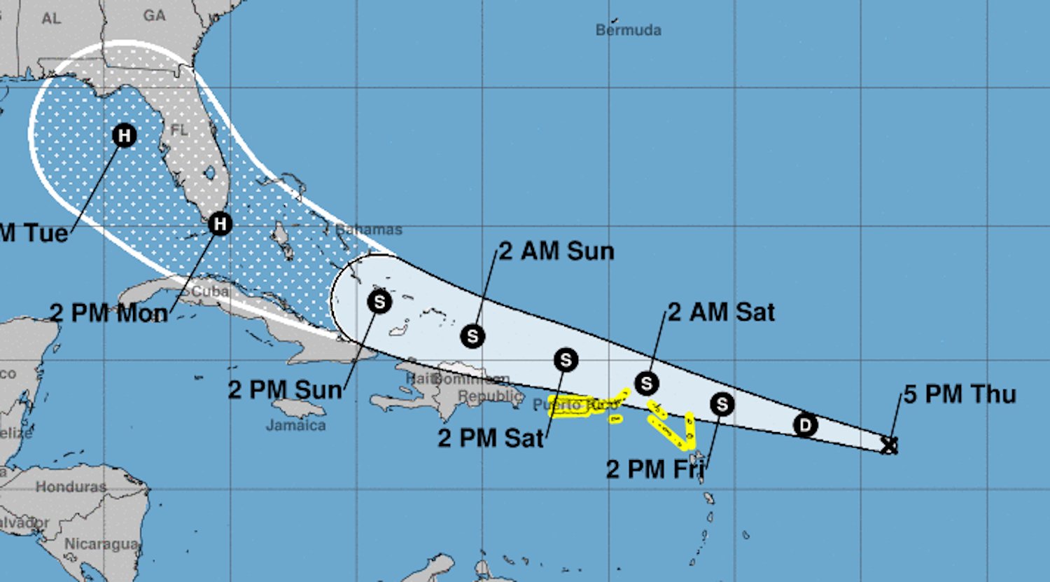
Daytona Beach, FL - Early forecasts from the National Hurricane Center show Florida within the path of Tropical Depression 13, which is currently headed towards the Lesser Antilles.
As of their 5 p.m. advisory on Thursday (August 20th), forecasters found the depression to be moving toward the west-northwest near 21 mph, a path its expected to continue on for the next few days.
On its current track, the depression is expected to move near the northern Leeward Islands by late Friday (August 21st), then near the Virgin Islands, Puerto Rico then Hispaniola on Saturday (August 22nd).
According to the NHC, Maximum sustained winds are near 35 mph with higher gusts. Forecasters also expect the storm to strengthen into a tropical storm by Friday. If and when it does, TD 13 will be named Tropical Storm Laura, the 12th storm of the 2020 Atlantic Hurricane Season.
However, even with Florida inside of its forecast cone, the NHC says there is some uncertainty in long-range forecasts since the system could move over the Greater Antilles.
Still, the system could bring storm surge, rainfall and high winds to the areas of Hispaniola, Cuba, the Bahamas and Florida this weekend and early next week.
Tropical storm watches have also been issued for the Antilles.
News Daytona Beach will monitor Tropical Depression 13 and provide updates when available.


