Daytona Beach, FL - The latest data from the National Hurricane Center in Miami shows that the next 24 hours could bring a tropical storm that's likely to affect Florida by the weekend.
As of Wedensday (July 29th) morning, it was known as Potentical Tropical Cyclone 9 (PTC 9). But, before sunrise Thursday morning (July 30th), PTC 9 will most likely become Isaias, the ninth named storm of the 2020 Atlantic Hurricane Season.
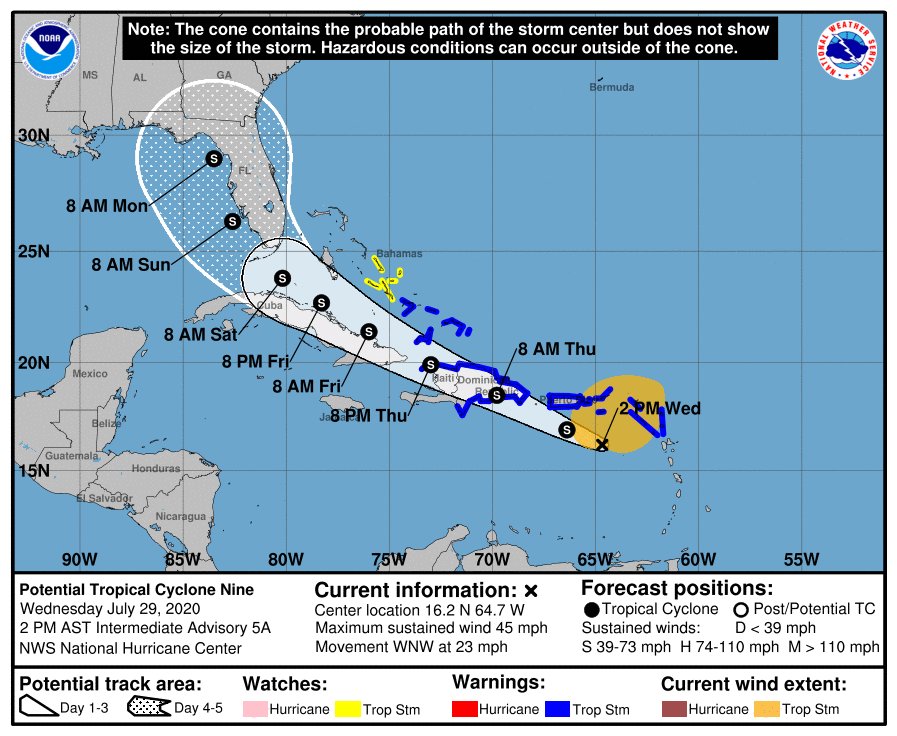
The current outlook from the NHC says the system will likely bring tropical storm conditions to the Leeward and Virgin Islands and Puerto Rico before spreading westward towards portions of the Dominican Republic, Haiti, the Bahamas and the Turks and Caicos on Thursday.
The NHC's current 5-day forecast takes the system through the Caribbean and towards the Florida Keys before a turn northward up the Gulf coast. However, forecasters are still uncertain about the system's track, as it does not have a well-defined center.
If the storm were to follow its current forecast track, Floridians could begin to feel the effects of the system – which is so far not expected to strengthen beyond tropical storm strength – later in the week and into Saturday morning (August 1st).
News Daytona Beach will monitor the situation and provide updates when available. You can download our free app (available on all Apple and Android devices), or follow us on Facebook and Twitter to stay up to date.


