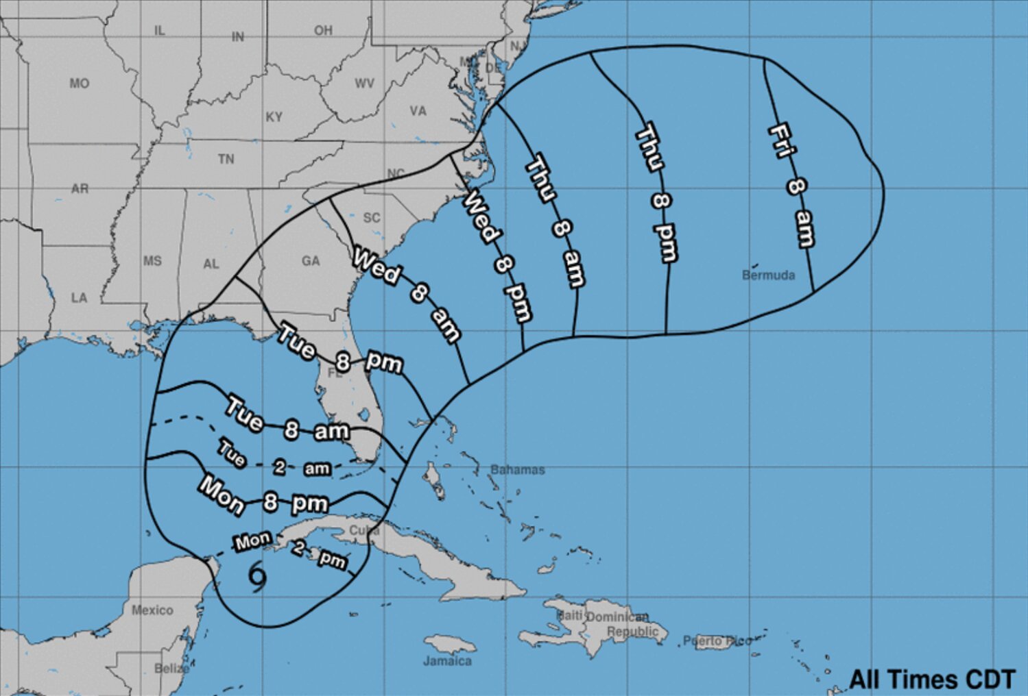
The path of Tropical Storm Idalia is now expected to include Volusia and Flagler counties, according to leading meteorologists. Residents of both counties are urged by local officials to begin making preparations for strong winds over the next few days.
As of Monday afternoon both Volusia and Flagler Counties are under a local Tropical Storm Watch. Governor Ron DeSantis has amended an already-declared state of emergency to now also include both counties. The state government is mobilizing 1,100 Florida National Guard personnel, 25 Florida Department of Law Enforcement officers, 300 Florida Highway Patrol Troopers, and a fleet of Florida Fish & Wildlife vehicles to assist in hurricane response.
The latest figures from the National Oceanic & Atmospheric Administration (NOAA) forecast tropical storm-force winds to arrive in the Volusia/Flagler area some time between Tuesday evening and Wednesday morning. A tropical storm watch has been issued for much of Florida's east coast from Jacksonville to around Melbourne.
"This is potentially a serious situation for Volusia County," said Volusia Emergency Management Director Clint Mecham. "We encourage everyone to monitor weather reports, make a family plan, and consider stocking a disaster supply kit."
"We urge all of our residents to complete preparations, on Monday, as if a Category 1 hurricane is approaching our area," said Flagler County Emergency Management Director Jonathan Lord. "Even if our impacts will likely be more tropical storm-like."
Coastal residents should frequently monitor evacuation alerts in their area, in the event emergency officials deem it necessary. Updates are also expected from the Volusia County School District and Flagler Schools on potential class cancellations, if the situation rises to that level.
Below is a list of sandbag locations as of Monday afternoon in Volusia and Flagler counties. Please note, sand pile stations are self-serve only, and many locations ask for proof of residency.


