Many counties in Florida have been placed under a Tropical Storm Warning by the National Weather Service (NWS) as of Wednesday due to the impending impact of Hurricane Helene. The storm became a Category 1 hurricane Wednesday morning as it passed by the Yucatan Peninsula in Mexico.
A tropical storm warning was issued for much of the state early Wednesday morning, even for areas not expected to receive the full brunt of the storm. Among those areas are Flagler and Volusia counties, with both the coastal and inland areas of the counties being affected. Residents should be prepared for high winds, rain, and storm surge Wednesday and/or Thursday. Helene should be directly east of Flagler and Volusia counties sometime late Thursday afternoon.
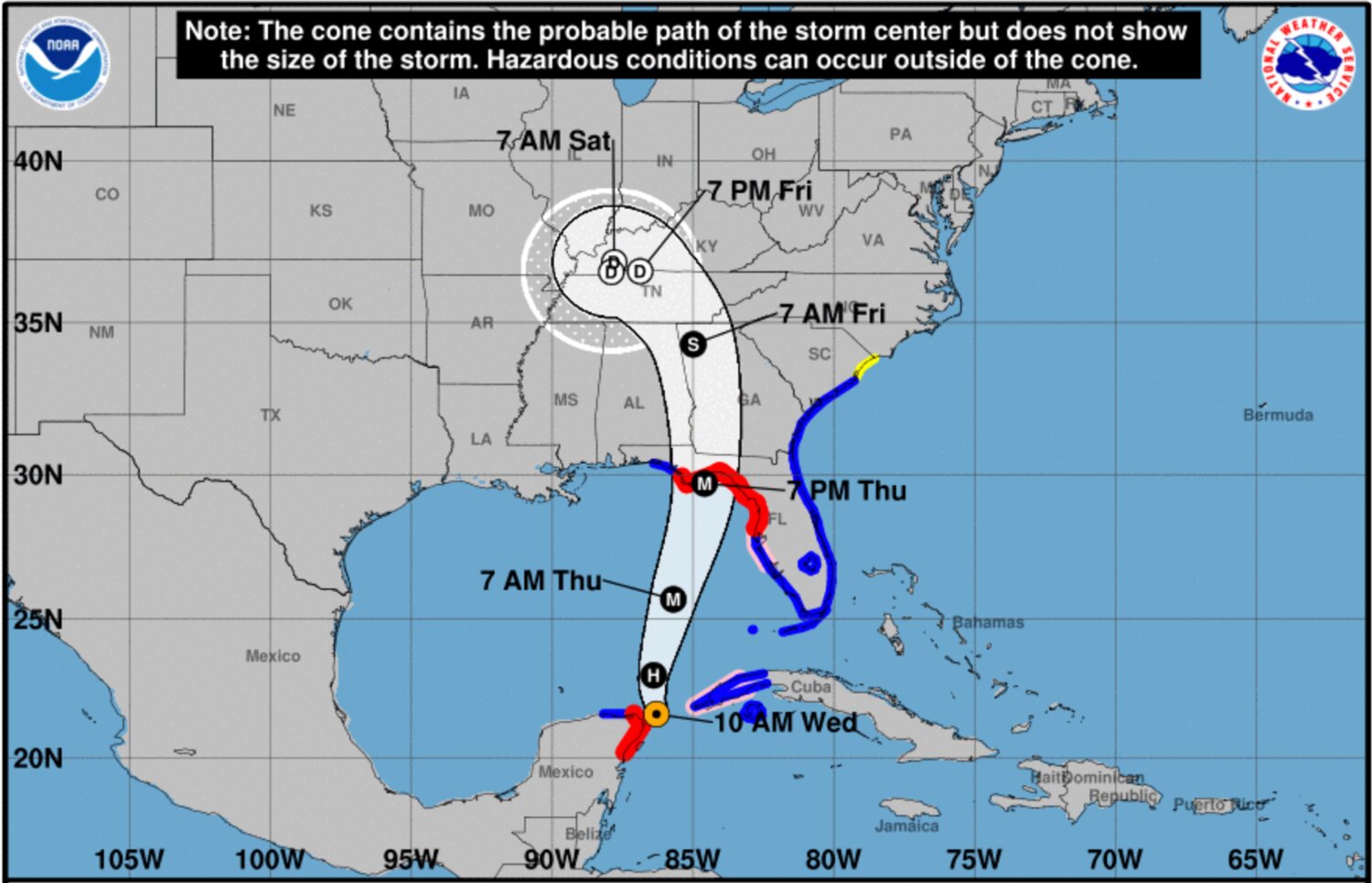
According to hurricane expert Michael Lowry, Helene is one of only five named storms to reach its projected size over the Gulf of Mexico since 2000, joining Irma, Ike, Ivan, and Isidore.
Winds in Volusia County are projected at similar intensities as Flagler in the latest release by the NWS. The coastal area of the county is expected to see 30 to 40 miles per hour with gusts up to 55 miles per hour. Rainfall is expected to reach one to three inches. Like in Flagler, Volusia may see tornadoes during the storm’s duration. Inland Volusia has an easier forecast, with 20 to 30 mile-an-hour winds gusting up to 50. Rainfall is still one to three inches, and tornadoes remain a possibility. A flood warning is also in effect for Volusia from Wednesday evening to Friday morning.
Volusia County is closing beach driving and after-school activities on Thursday, as well as inlet parks and Votran services if necessary. School and district offices will also be closed. Residents with questions about Hurricane Helene are encouraged to call the Volusia County Citizens Information Center Wednesday, or between 8:00 am and 6:00 pm Thursday. More information is available on the Volusia County Emergency Management mobile app, and on the agency’s social media pages.
Sandbags are being distributed throughout much of Volusia County, both by city and government operations. Residents will be able to obtain sandbags in some locations all the way up to Thursday, but most would be well-advised to do so on Wednesday if they plan on getting any at all. The full list of Volusia County sandbag locations is available here.
“We are expected to get a couple of inches of rain between now and Saturday with some isolated areas receiving more,” said Flagler Emergency Management Director Jonathan Lord. “Winds for Thursday are expected to range between 25 and 35 mph, and gusts of about 40 mph inland and 50 mph at the coast. We do not anticipate that we will need to order evacuations or open shelters, but we do have a plan in place in case that needs to change.”
Flagler County has made sandbags slightly more attainable for residents, after previously sending them to hardware stores to pay potentially hundreds of dollars for what’s historically been a free service. The sand itself is being made available, though residents are still responsible for bringing their own bags and shovels.
“The Atlantic Ocean and the Intracoastal Waterway may see elevated tides of between 1 and 3 feet above normal,” Lord continued. “If you live in a flood-prone area, you may want to take extra protective measures. Flagler County has made sand available for residents (self-service: bring bags and a shovel) at the following: Bay Drive Park, 30 Bay Drive, near the retention pond; and at Hidden Trails Community Center, 6108 Mahogany Boulevard. Presently, sandbags are readily available at local hardware stores.”
Winds in Flagler County are expected to reach 25 to 35 miles per hour with gusts up to 60 miles per hour according to the NWS. Winds should be slightly weaker in the more inland portions of the county, such as Bunnell, Espanola, and Andalusia. Rainfall is forecasted at one to three inches, and tornadoes are being considered a possibility. In addition to the Tropical Storm Warning, a Flood Watch will be in effect Wednesday evening through Friday morning.


